Weko Beach Foredune Recovery Study
The Lake Michigan coast experienced record high water levels between 2013 and 2020, which led to widespread beach erosion and loss of foredunes. Now that water level is back to near the long-term average, will the dunes come back?
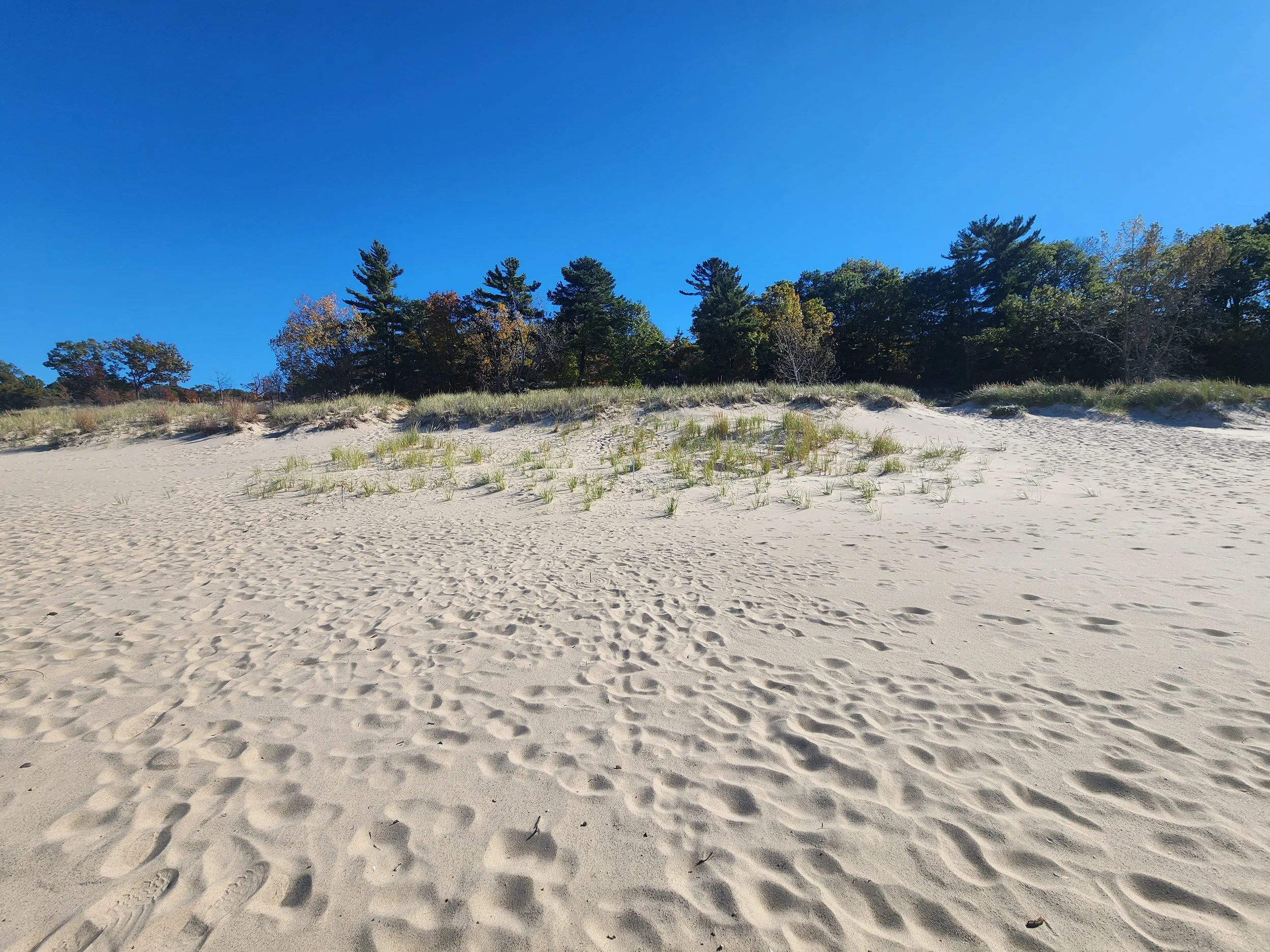
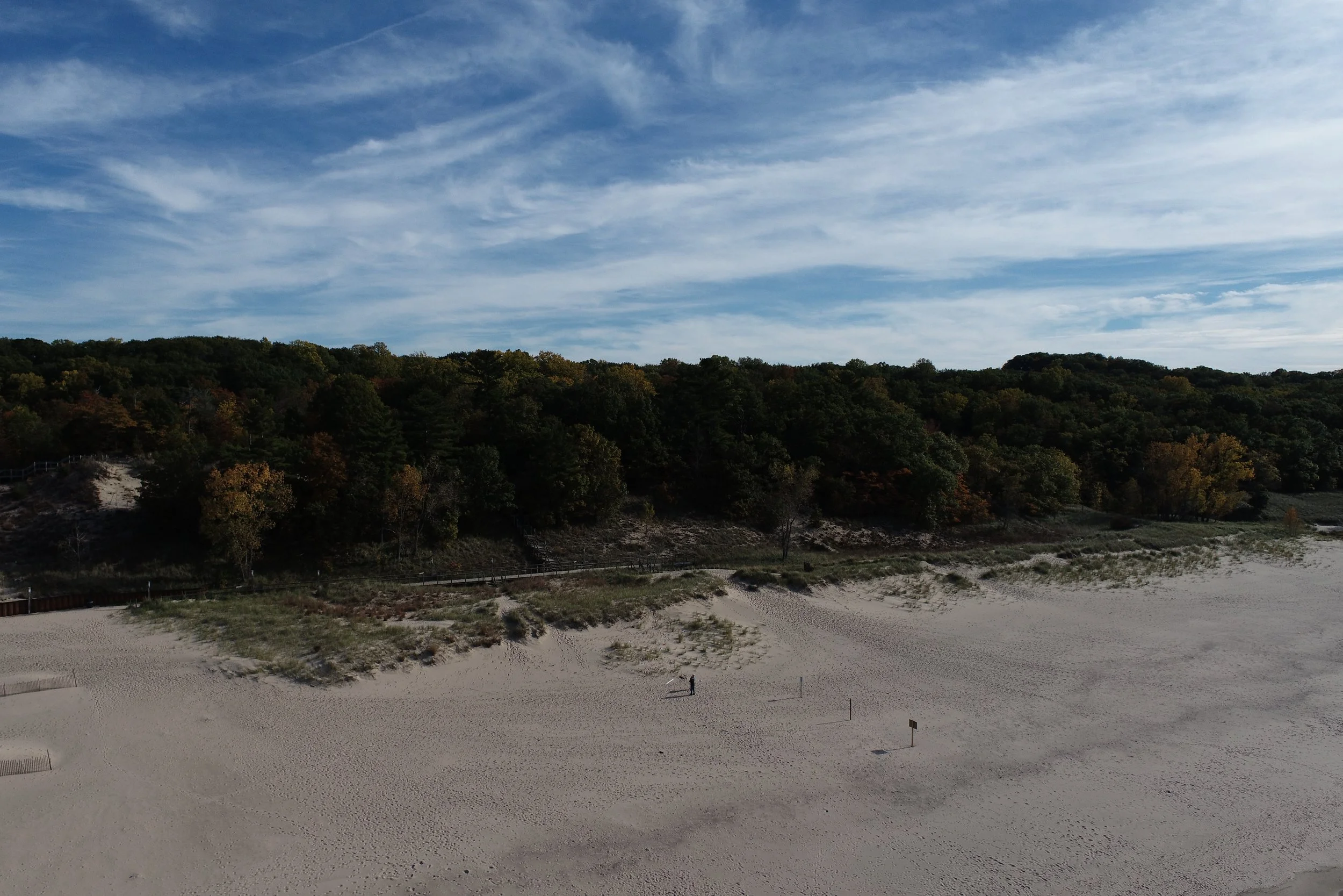
The purpose of this study at Weko Beach (Bridgman, MI) is to monitor foredune recovery during a period of falling lake level. Prior to the high lake levels of 2013-2020, the foredunes on the south end of the beach extended much further lakeward (~20-40 m). As water level rose to a peak in 2020 the dunes were inundated with water and subjected to wave erosion. Now that water level has lowered, the beach has widened and there is an exciting opportunity for dunes to rebuild. Dune grass is starting to colonize the bare sand and extend towards the shoreline (as seen in the photo above). By periodically mapping the elevation of this area, we can track sand deposition around the dune grass- rebuilding foredunes.
Community Science Foredune Mapping
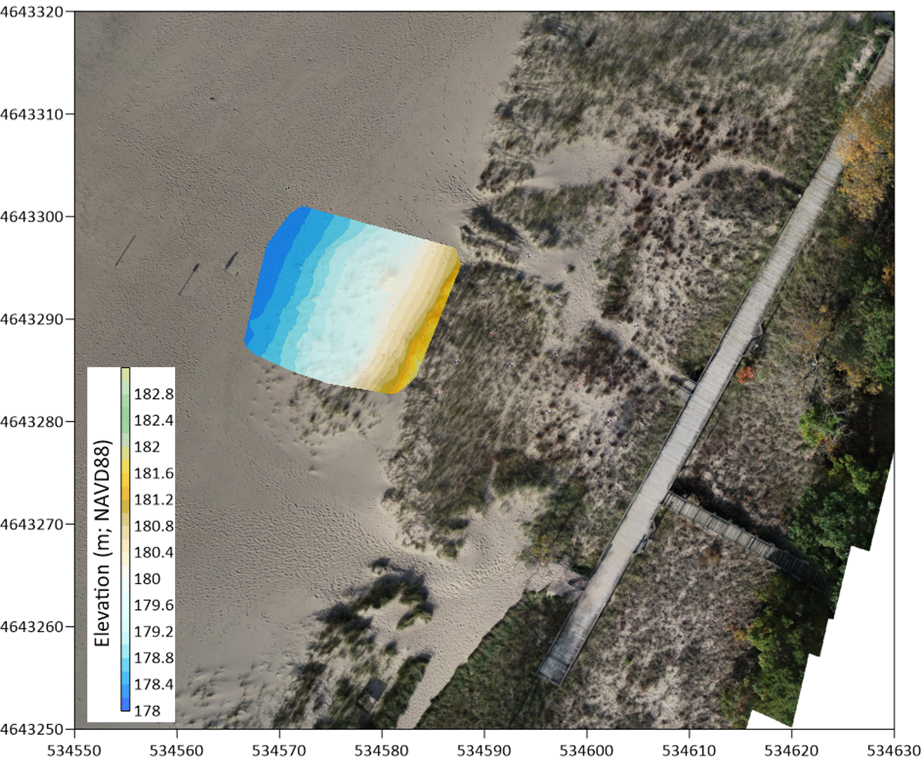
Drone imagery and initial iPad elevation map of the foredune site on October 27, 2025.
The other purpose of the study is to explore using Apple LIDAR as a tool for community science-led coastal change mapping. The LIDAR uses a laser to collect elevation measurements that can then be used to create a digital model of the site. If the same area is mapped multiple times, then the maps can be compared to find changes in elevation (gain or loss of sand). Members of the Bridgman Shoreline Committee have been trained to collect Apple Lidar data and send it back to our lab. We process these data and then share the products back to the community.

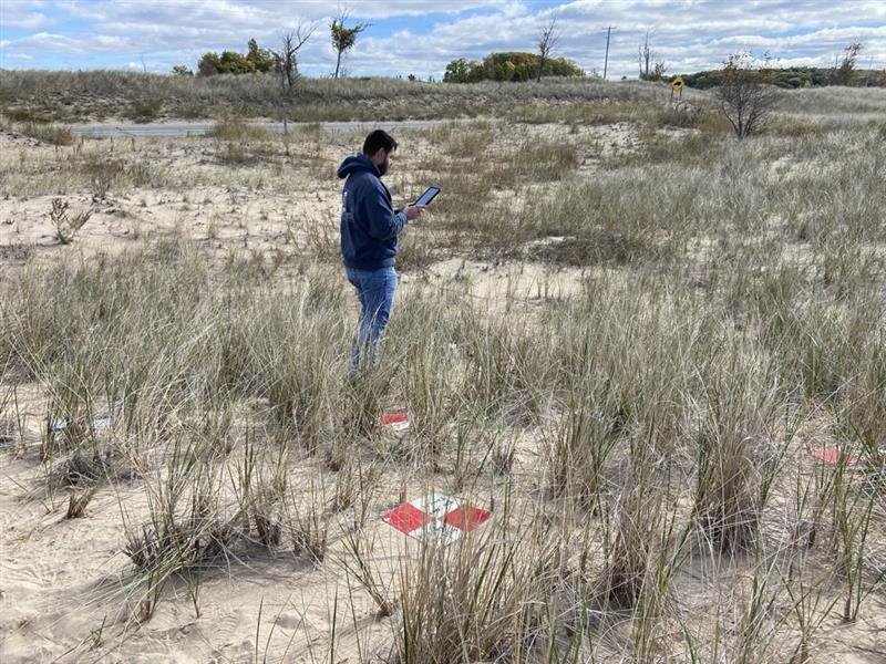
How we collect data?
Elevation data are collected with the Apple Lidar by scanning the area with an iPad. Ground Control Points (GCPs), which are the black and white tiles on the metal poles, are placed before each survey. These GCPs are mapped with a GPS to measure the exact position and elevation and are then used to reference our LIDAR data to real geographic coordinates. By placing these semi-permanent ground control points and surveying them once, we can process any LIDAR data collected with the iPad by community members without having to physically be there placing new GCPs each time.
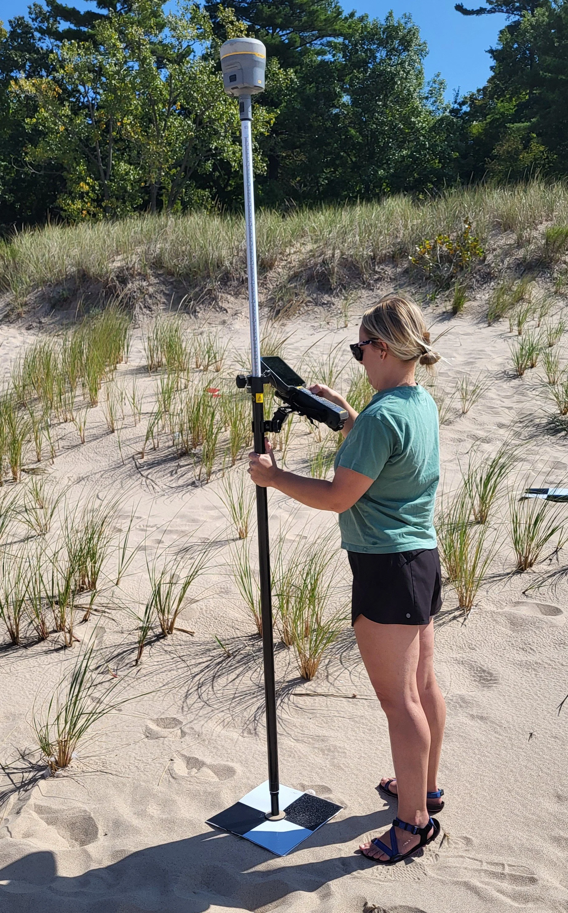
Using the RTK-GPS to survey ground control points
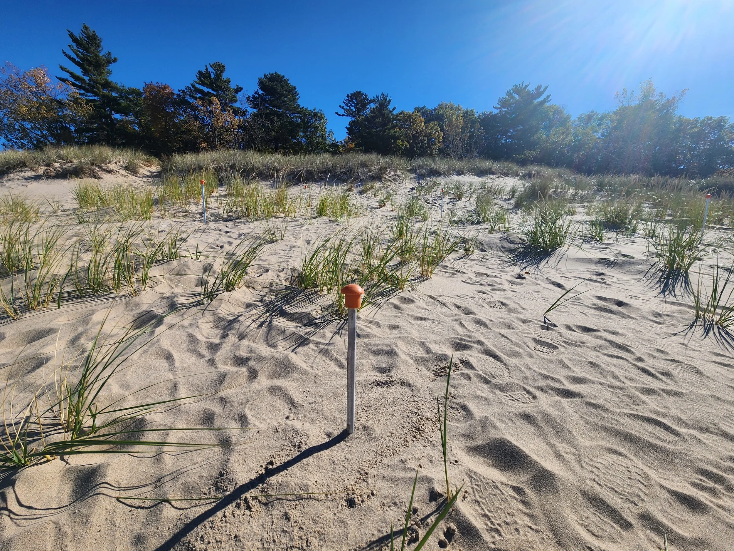
The pole stays in the ground at all times. The GCP gets attached each time we use the iPad to survey
These semi-permanent poles are placed in the foredune site. Before each iPad scan the community scientist attaches a GCP to the top of the pole and removes it when the scan is complete.
It is critical that these poles remain in the exact same position. Please do not move or adjust the poles!
Using the iPad to scan the dune